Imagery or basemaps and Earth cover
Department of Geology and Mines
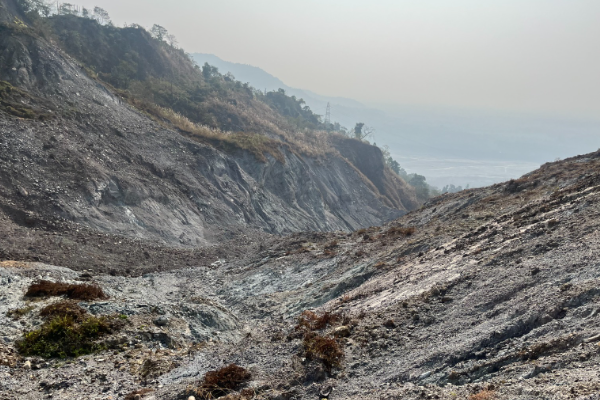
Landslide Inventory of Samtse Dzongkhag Category: Open
Samtse Dzongkhag, located in Bhutan’s southern foothills, is among the most landslide-prone regions in the country due to its fragile geology, intense monsoon rainfall, and increasing anthropogenic activities. Geologically, the area lies within the tectonically active Siwalik and Lesser Himalayan zones and is traversed by major fault systems, including the Main Frontal Thrust (MFT) and Main Boundary Thrust (MBT), as well as numerous local faults and folds. These structural features have fractured and deformed the rock mass, which is primarily composed of highly to completely weathered phyllite, quartzite, sandstone, and siltstone, all of which are weak and highly susceptible to failure when saturated.With annual rainfall often around 4,000 mm, coupled with widespread slope disturbances from road construction, riverbank erosion, deforestation, and settlement expansion, landslides have become a recurring hazard. Field validation confirmed that 9 out of 15 gewogs, particularly Samtse and Phuentshopelri, are severely impacted. A total of 59 landslides were documented, most of which remain active and are concentrated along thrust zones. Among these, 16 landslides (27%) were identified as critical due to their high vulnerability to settlements and key infrastructure.The study focused on landslides with direct or observable impacts on settlements and infrastructure. Remote or less accessible areas were excluded due to time and logistical constraints but should be included in future assessments, considering the evolving and uncertain nature of landslide hazards.
Keywords: [#Geohazards]